arrow_back
Montgiscard / Seuil de Naurouze Canal des 2 Mers by bike - Atlantic / Mediterranean sea
26,92 Km
1 h 49 min
I begin / Family
26,92 km cycling route from Montgiscard to Seuil de Naurouze
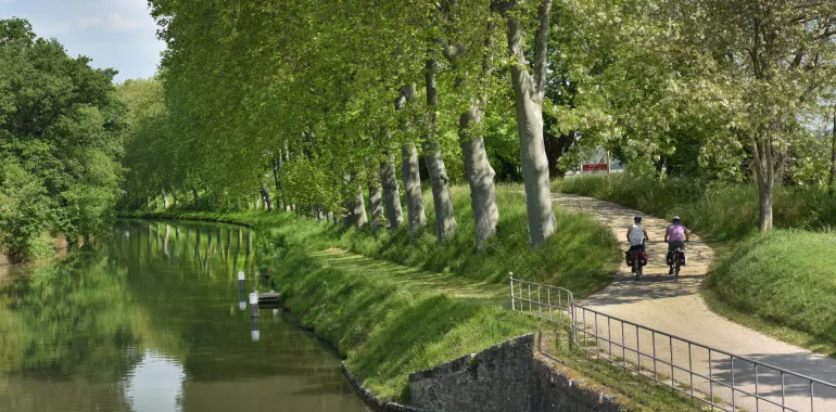
Up to Le Seuil de Naurouze, the Canal du Midi is shadowed by the Autoroute des 2 Mers motorway, but these parallel ways are worlds apart. Centuries-old plane trees continue to provide green shade for cyclists enjoying a journey transporting them back in time to another era. You should thank the canal’s Ancien Régime designer, Pierre-Paul Riquet, the many wondrous architectural designs along the canal attesting to his genius.
Elevation of the stage
0 m 32 m
Waytypes of the stage
Cycle path: 26,92 km
Surface of the stage
Unknown: 26,92 km
The route
Follow a tarmacked, signposted greenway from the centre of Montgiscard up to Le Seuil de Naurouze – don’t hesitate to wander around the latter, at the watershed point dividing the waters flowing to the Atlantic from those flowing to the Mediterranean, and an exceptional sight.
SNCF train stations
Villefranche-de-Lauragais train station:
TER regional trains serve > Toulouse; Castelnaudary/Carcassonne (numerous trains daily)
Connections at Toulouse for Montauban/Agen/Bordeaux; Brive/Limoges/Paris; Albi/Castres/Rodez/Figeac; Tarbes/Pau/Foix.
Connections at Carcassonne for Narbonne/Béziers/Sète/Montpellier/Marseille; Limoux


Travellers’ reviews