arrow_back
Capestang / Béziers Canal des 2 Mers by bike - Atlantic / Mediterranean sea
20,61 Km
1 h 19 min
Mountain Bike advised
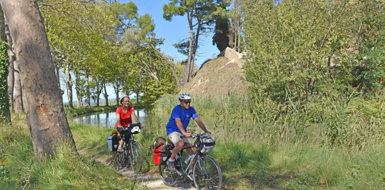
20,61 km cycling route from Capestang to Béziers
This stage is packed with surprises. The 17th-century Tunnel de Malpas draws the attention, built as Europe’s first-ever navigable canal tunnel. On the hill above, visit the impressive vestiges of a pre-Roman, Celtic settlement, the Oppidum d’Ensérune. From here, look down on the amazing pattern of the dried-out circular lake of Montady, originally dug by medieval monks. Then admire the extraordinary nine locks of Fonsérannes and the splendid canal-bridge over the Orb River with magnificent views up to historic Béziers.
Elevation of the stage
Waytypes of the stage
Cycle path: 18,26 km By road: 2,24 km Unknown: 0,11 km Provisional itinerary: 20,61 km
Surface of the stage
Smooth: 1,68 km Rough: 17,18 km Unknown: 1,75 km
The route
The track along the towpath is not specially laid out for cyclists and is rough in patches.
Off the route
Just 2km away from this stage, Nissan-lez-Ensérune is one much-appreciated stopping place, but the very lively port of Colombiers makes another tempting option for a stop.
Gares SNCF
Béziers train station:
TER regional trains and Intercités trains serve > Narbonne/Carcassonne/Toulouse/Bordeaux; Agde/Sète/Montpellier (many trains daily); Avignon/Marseille (3 to 4 trains daily); Millau/Rodez/Clermont-Ferrand
Connections at Montpellier for Lyon/Paris; Nîmes/Alès/Clermont-Ferrand.
Tourist offices

Travellers’ reviews