L'écluse du Libron sur le canal du Midi
Le Canal des 2 mers à vélo - J. Damase
Arrivée à Agde le long du canal du Midi à vélo
Le Canal des 2 mers à vélo - J. Damase
Les 9 Ecluses Fonseranes du Canal du Midi à Béziers
Le Canal des 2 mers à vélo - J. Damase

The Canal du Midi

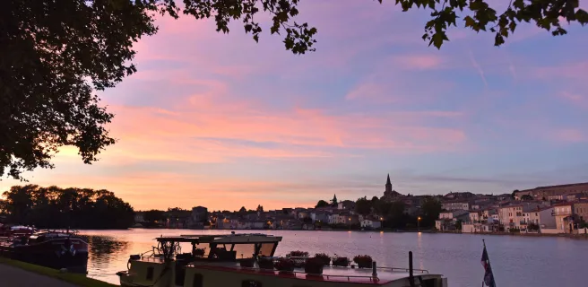
A canal listed as a UNESCO World Heritage Site

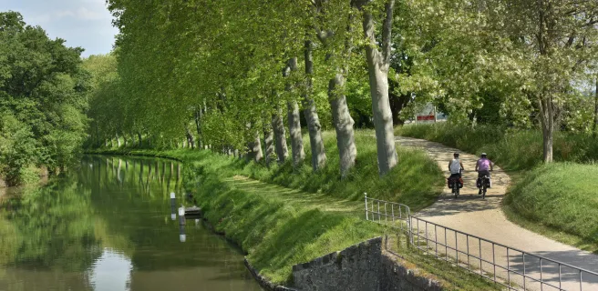
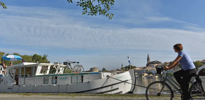
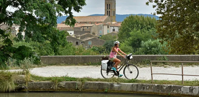
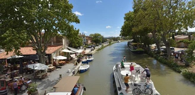
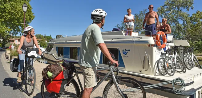
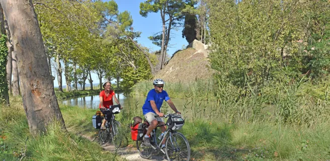
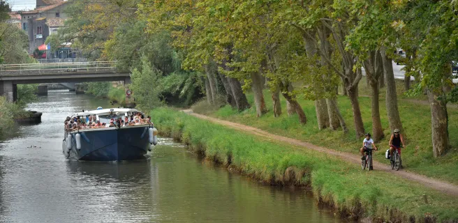
The Canal du Midi is considered a masterpiece of French engineering, linking Toulouse to the Mediterranean via a waterway running for almost 250 kilometres. The Canal du Midi is now much appreciated by boating tourists, hikers and cyclists. The cycle route beside the canal is still being developed at time of writing.

Le long du Canal du Midi à vélo entre Carcassonne et Trèbes
Le Canal des 2 mers à vélo - J. Damase

The Canal du Midi in figures


  • 240km in length
  • over 14 years in the making (1666 - 1681)
  • 350 architectural works constructed, including 63 locks, 126 bridges, 55 aqueducts and 7 canal-bridges
  • 12,000 workers were employed on the canal at the height of its construction, these workers using pickaxes and their bare hands to excavate 7 million m3 of earth and gravel.
  • Opened to traffic: 1681
La Redorte à vélo - Canal du midi
J. Damase

An idea from the Roman Empire

The idea of a canal connecting the Mediterranean to the Atlantic was already considered in Roman times. It was an important aim for the Romans to try and move men and supplies from the Med to northwest Europe without having to go all the way round the Iberian Peninsula to reach the Atlantic. Such a route would have allowed them to control their colonies in northwest Europe more easily, both militarily and politically. The technical issues and astronomic costs of such a project thwarted those who wished to turn the dream into reality, from Roman Emperor Nero to 17th-century French king Henri IV.

Le Canal du Midi à vélo de Toulouse à Carcassonne
J. Damase

The oldest canal in Europe still in operation

It was only thanks to the exceptional skills of Pierre-Paul Riquet, in the 17th century, that the project became a reality. Plans for the canal began to take shape in 1662. After some 14 years of work, it was completed in 1681, due to the labours of over 12,000 men and women. 


In 1857, the Canal Latéral à la Garonne linking Bordeaux to Toulouse was constructed, allowing boats to cross all the way between the Mediterranean and the Atlantic, avoiding the vast detour around the Iberian Peninsula.


Passage du tunnel du Malpas en bateau
J. Damase

A technical achievement

In 1857, the Canal Latéral à la Garonne linking Bordeaux to Toulouse was constructed, allowing boats to cross all the way between the Mediterranean and the Atlantic, avoiding the vast detour around the Iberian Peninsula.

For almost two centuries, the Canal du Midi flourished, used for transporting people and merchandise. The trip by canal between Toulouse and Sète (on the Mediterranean) could last up to four days for passengers and eight days for merchandise.


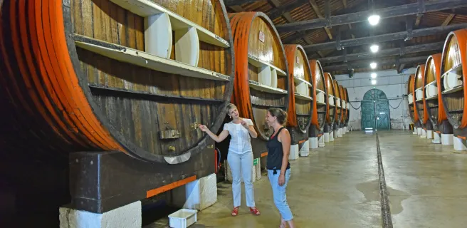
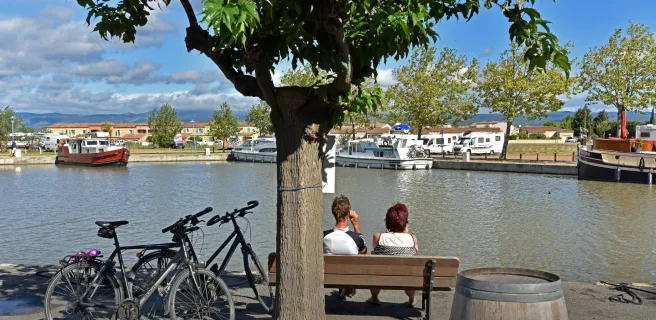
Up until the arrival of the railway line in the middle of the 19th century, the canal was not subjected to any real competition. With trains, transport by waterway declined slowly, with passenger transport being abandoned to train transport by the end of the 19th century, then freight transport by waterway coming to an end in 1989. Since then, the Canal du Midi, which also serves to irrigate the fields round and about, has been saved by boating tourism (with c.100,000 users a year) and by numerous hikers and cyclists appreciating it.

Sous les platanes du canal de Garonne
France Vélo Tourisme

SOS platanes

Les platanes qui bordent le canal du Midi sont menacés de disparition… Le chancre coloré est un champignon microscopique qui se loge à l’intérieur du platane et bloque ses canaux de sève. Ainsi, il parvient à tuer cet arbre en très peu de temps, entre 6 mois et 5 ans.

La maladie se propage par contact : soit par les racines (très imbriquées), soit par blessure due au frottement des bateau ou au passage de promeneurs à vélo.

La propagation est rapide et malheureusement sans remède. Il n’existe à ce jour qu’une seule solution pour l’endiguer : abattre et brûler les arbres touchés. D’où les campagnes d’arrachage en cours le long du canal. D’autres variétés d’arbres sont peu à peu replantées pour se substituer à ces derniers.


QUELQUES CONSEILS POUR ÉVITER LA PROPAGATION DU CHANCRE COLORÉ 

  • Ne pas blesser les arbres
  • Ne pas graver l’écorce avec un objet pointu
  • Eviter de déposer les vélos contre les arbres
  • Eviter de s’arrêter sous les arbres secs
  • Rester prudent à l’approche des zones de chantier et respecter la signalisation
  • Emprunter les déviations mises en place

En savoir plus : www.replantonslecanaldumidi.fr

Custom route

Custom route

Toulouse / Montgiscard

16 Toulouse / Montgiscard

21 km
1 h 25 min
I begin / Family
Leave Toulouse via the greenway beside the Canal du Midi, a path that is very popular with local cyclists avoiding the car-clogged city roads. The canal-side route transports you swiftly into parts shaded by centuries-old plane trees, where old barges lie sleepily in the water. Soon, the village of Montgiscard appears, and you feel you’ve left the big city behind to enter the Lauragais farmlands.
Montgiscard / Seuil de Naurouze

17 Montgiscard / Seuil de Naurouze

27 km
1 h 49 min
I begin / Family
Up to Le Seuil de Naurouze, the Canal du Midi is shadowed by the Autoroute des 2 Mers motorway, but these parallel ways are worlds apart. Centuries-old plane trees continue to provide green shade for cyclists enjoying a journey transporting them back in time to another era. You should thank the canal’s Ancien Régime designer, Pierre-Paul Riquet, the many wondrous architectural designs along the canal attesting to his genius.
Seuil de Naurouze / Castelnaudary

18 Seuil de Naurouze / Castelnaudary

13 km
49 min
Mountain Bike advised
Going from lock to lock, the canal’s towpath leads you through the heart of the Lauragais area. Le Seuil de Naurouze, at the watershed dividing the waters flowing to the Atlantic from those flowing to the Mediterranean, is a key point on the Canal du Midi, supplied by the Rigole de la Plaine channel coming down from St-Ferréol Lake. The canal continues to the town of Castelnaudary, capital of famed cassoulet bean and meat stew, but also boasting the largest canal basin on the Canal du Midi.
Castelnaudary / Bram

19 Castelnaudary / Bram

17 km
1 h 06 min
Mountain Bike advised
Leaving Castelnaudary, you pass the imposing St-Roch lock with its four interconnecting chambers. Further on, at the level of Bram’s port and the canal-side restaurant, l’Ile aux Oiseaux, a cycle track allows you to make a short detour into the centre of Bram, a town which stands out for its silhouette and its circular medieval centre, known as a ‘circulade’, a form typical of the Aude.
Bram / Carcassonne

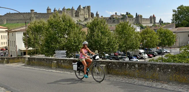
20 Bram / Carcassonne

24 km
1 h 36 min
Mountain Bike advised
From Bram to Carcassonne, the route runs alongside the Canal du Midi, which is in no rush, so take your time to linger over this beautiful stage. You come to the port in the lower town of Carcassonne, built originally as a fortified medieval grid-plan bastide. Above, Carcassonne’s mighty medieval citadel atop its hill dominates the surrounding countryside. Listed as a UNESCO World Heritage Site since 1997, the citadel encourages many cyclists to make a significant halt on the route here.
Carcassonne / Marseillette

21 Carcassonne / Marseillette

22 km
1 h 28 min
Mountain Bike advised
Not one, but two bridge-aqueducts were needed to cross the Fresquel and Orbiel Rivers to reach Trèbes, with its lively port, its canal-side cafés-restaurants and its church of St-Etienne, in the heart of the historic village. The Minervois area and its reputed vineyards lie just a short cycle ride away from the Canal du Midi here.
Marseillette / Homps

22 Marseillette / Homps

18 km
1 h 13 min
Mountain Bike advised
This stage is dotted with admirable technical feats, in particular the astonishing hydraulic overflow facility designed for the Canal du Midi at La Redorte by the great 17th-century engineer Vauban. Homps, an historic wine-exporting port, is very lively, with many shops, and a bit of a shock after the sleepy atmosphere along much of the canal. Here you find yourself in the heart of the Minervois area. Close to Homps, Jouarres Lake offers you the possibility of going bathing.
The Canal du Midi by bike : Homps / Le Somail

23 The Canal du Midi by bike : Homps / Le Somail

20 km
1 h 19 min
Mountain Bike advised
A string of wine-making villages, Argens-Minervois, Roubia, Paraza and Ventenac-en-Minervois, congregate here beside the Canal du Midi, calling for your attention! Le Somail’s port was where the canal’s designer, Pierre-Paul Riquet, calculated that the post barge should stop for the couchée, or sunset, on the third day of its trip from Toulouse. Now, Le Somail is one of the canal’s most attractive stops, a picture-postcard village with its port, chapel, canal-side accommodation and amazing antiquarian bookshop.
Le Somail / Capestang

26 Le Somail / Capestang

23 km
1 h 31 min
Mountain Bike advised
It’s a wrench leaving enchanting Le Somail. Although the port of Sète is a long way off, this is just a short stage to Capestang, signalled by the bell tower of St-Félix Church, which guides you to this village’s central square, where you can enjoy a rest in the shade of the plane trees.
Capestang / Béziers

27 Capestang / Béziers

21 km
1 h 19 min
Mountain Bike advised
This stage is packed with surprises. The 17th-century Tunnel de Malpas draws the attention, built as Europe’s first-ever navigable canal tunnel. On the hill above, visit the impressive vestiges of a pre-Roman, Celtic settlement, the Oppidum d’Ensérune. From here, look down on the amazing pattern of the dried-out circular lake of Montady, originally dug by medieval monks. Then admire the extraordinary nine locks of Fonsérannes and the splendid canal-bridge over the Orb River with magnificent views up to historic Béziers.
Béziers / Agde

28 Béziers / Agde

26 km
1 h 37 min
Mountain Bike advised
From the port at Béziers, the Canal du Midi à Vélo cycle route heads east towards the Mediterranean. You might halt briefly at Villeneuve-lès-Béziers or at Portiragnes before arriving at the Pont de Roque Haute. From here, Portiragnes Beach lies very close by and you can reach it easily for a refreshing dip in the Med! Further on, the mobile bridge built to control the River Libron and the round lock at Agde are extraordinary curiosities.
Agde / Sète

29 Agde / Sète

25 km
1 h 36 min
Mountain Bike advised
The town of Agde, with its ancient roots and black basalt architecture, is a startling place. Its soaring church tower looks down on the Hérault Estuary. You’re now reaching the very end of the Canal du Midi à Vélo cycle route, which finishes by the massive Etang de Thau coastal lake and Les Onglous Lighthouse at Marseillan-Plage resort. From here, the superb Lido greenway runs alongside the Mediterranean up to the great port of Sète. Stop for a dip at any point!